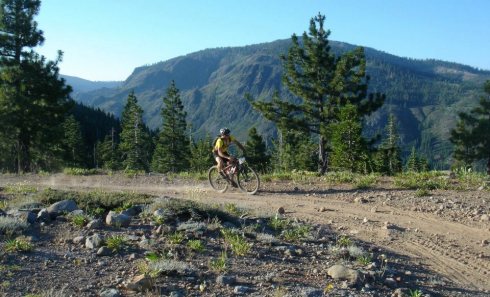
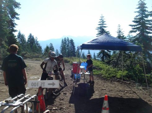
2012 Tahoe-Sierra 100 Mile MTB Race Report (1st Place, Pro Singlespeed) Posted on July 19th 2012
Sixty-six miles in and thirty-seven left to go, the coil tightened it’s grip on my femur, a double stranded helix of pain that was DNA deep. It crushed to the core and finally stopped me in my tracks, frozen in the heat; hunched, hysterical. This was the worst one I’d ever felt; raw, relentless and instant. It was one thing to pedal through the small fleeting dull ones. The shallow shadowy ones that would flare up slowly and say hello, fire the first warning shot through my nerves, then slide silently back down into my fibers. But this one was something else, an electric eel that slithered by my defenses unnoticed, wrapped and coiled itself up around and through my quad, then wrecked and wrenched down with the strength and surprise of a rogue wave in the middle of the dark open ocean.
Yeah wow, I sure didn’t see that one coming. I better get to the Michigan Bluff aid station soon.
The cramp of a lifetime probably would have been avoided if, forty-two miles earlier, I hadn’t crashed on the singletrack of Red Star Ridge. It was a small crash, a simple stuff of the front tire into some too soft dirt with too much speed trying to make too tight of a turn, but one that had large consequences: It ripped the Garmin GPS off of my stem. I didn’t even noticed it until a few miles later when I exited Red Star Ridge, began bombing down to the bottom of the Glen Mine climb, looked down to check the time and it was gone. Shit. Riding and flying blind with about seventy-five miles and eight hours of riding ahead with no way to check the time of day, no way to check how my pacing was going, no way to be sure of how far I’d ridden nor how much farther the next aid station would be, and thus no way to exactly know if my electrolyte consumption and fueling schedule was on track or was falling off the tracks. Needless to say, it fell off the tracks. More accurately, it got smashed head on by a bullet train then blown off the track in bits. Commence cramp of a lifetime.
When I made it to the small town of Michigan Bluff, mile sixty-eight, I was confused. I thought a street fair or carnival or something was going on. I heard music. “Here, let me take your bike”. I smelled bacon. I thought I saw someone dancing. “What do you need?!”. There were people riding bikes. There were people putting wet rags on the back of my neck. “This is gonna be cold!”. There were people handing out drinks. Is that someone playing a flute and charming a snake? Wait, I know these people. “Do you want your chain lubed? What do you want in your bottles??!”. Aha! I’m at the Mad Cat aid station. It could have been a dusty vendor street in downtown Marrakech for all I knew. Sure yeah, I’ll take all of that. Oh and a jar of pickle juice. And that little baggie filled with the sorta crushed up endurolytes, how much will those be? I’ll take those too.
I had always wanted to visit Marrakech but I had to be on my way. Next stop Foresthill.
As of that Saturday morning, at 6:00 AM while on the start line in Soda Springs,

the only sign that there was a massive forest fire that had just torched 2,000 acres in three days burning just to the North of the Tahoe-Sierra 100 race course was the gentle scent of a distant, sweet white smoke that was just barely there. Then as we pedaled off the pavement

and onto the dusty, rutted out portion of Soda Springs Rd,
climbed up to the first water station (mile 14)
and watched the sunrise splash on the Granite Chief Wilderness off to the left on top of Lyon Ridge,
descended off the backside, then pedaled toward French Meadows Reservoir, climbed up to Red Star Ridge (mile 24)
and picked up the Western States singletrack,
then descended a short bit on Mosquito Ridge Road to the loose and technical Glen Mine climb, then climbed past the Folsom Bike aid station (mile 39)
upwards and onwards to Cavanaugh ridge and again more technical Western States Trail singletrack, to Dusty Corners aid (mile 52),to contouring singletrack past Pucker Point,
then plunged straight down to the swinging bridge,
hiked and crawled back out the other side, refilled water bottles at Deadwood (mile 62), descended into El Dorado Canyon, hiked and crawled again back out the other side, visited Marrakech Bluff,
then flowed down some more fun technical twists and turns before one last final climb to Foresthill (mile 73), the scent slowly faded away and disappeared. Funny how that can happen when you’re focused on other things with the wind on your side. But while in Foresthill, the evidence of the Robbers Fire burning just to our North was in our faces: Evacuation centers, the Red Cross, large flame retardant tankers and water drop helicopters buzzing overhead.
We got lucky.
At Foresthill, a volunteer told me that it was 2.5 miles along Foresthill Road to the left hand turn on the south side that would lead us to the flowy Todd Valley trails. Then it was roughly 7.5 miles of downhill flow and fireroad descending to the bottom of the Ruck-a-Chucky rapids on the North Fork of the Middle Fork of the American River. This left me, on my singlespeed with an extremely spinny gear
with nearly 10 miles of relaxation. There’s just only so fast that you can go on a “false flat downhill” on pavement on a bike with one gear. So I took this opportunity to rest, recover, get passed by a few guys chugging along in their big rings, and refuel along the way in order to avoid any additional cramping episodes in the 20 miles or so that were left to the finish (especially since there were still 2 major climbs and lots of rolling singletrack ahead.
After climbing the hot and extremely hard (for me) Ruck-a-Chucky climb to the Drivers Flat Aid station where Folsom Bike and my wife and friends were volunteering, I knew I was nearly done. In fact in my head, I pretty much was done. From here on out, I knew the trails like the back of my hand. It wouldn’t matter anymore that my Garmin was gone and I had no idea how far along I was, I knew these trails well, and I was going to rip them to the finish. North side of Foresthill Divide, Westbound Connector trail, past the green gate and up the Oak tree, down the new-and-improved Culvert Trail, cross the road, fly above the river on Confluence Trail, pop under the bridge, speed on by and wave to the volunteers at aid station mile 98, and continue one last grunt up the 2.5 mile Stagecoach climb that by this time of the day was 100% in the shade and just fucking glorious, top out, then a couple of last meandering neighborhood roads to finish around 11 hours and 30 minutes. Good enough for 1st Place Singlespeed and 10th Overall.
Now a few days later, one recovery ride, a flight to the East Coast and several days or so of not riding, and my legs are still store. Jim Northey, the tireless organizer of this race calls it, “The Race of a Lifetime” on his website , while I can still feel the damage from the “The Cramp of a Lifetime” in my left quad. It hurts.
But damn, it hurts really good, and it feels like I did something.
(**Nearlly all ![]() photos courtesy of Jeff Barker — THANKS BRO!)
photos courtesy of Jeff Barker — THANKS BRO!)
Trackback URL


You must be logged in to post a comment.